






























San Francisco, California, USA
2016
Aerospace, Earth Observation, Defense, Geospatial Intelligence, Maritime, Environmental Monitoring, Infrastructure, Disaster Management
Capella Space is a space technology company developing and operating satellites equipped with synthetic aperture radar (SAR) for high-resolution Earth observation. Part of IonQ, the company provides radar imagery, geospatial intelligence, and spacecraft systems for commercial and government organizations. Its satellites use radar signals rather than visible light to capture information about Earth’s surface, enabling observation through cloud cover and during nighttime conditions. Capella Space combines satellite engineering, radar sensing, and automated data processing to support applications involving defense, maritime activity, infrastructure monitoring, and environmental analysis.
Capella Space designs, manufactures, launches, and operates radar imaging satellites that collect detailed information about Earth’s surface. Its satellite constellation provides high-resolution SAR imagery for organizations monitoring geographic areas, infrastructure, maritime activity, and changing environmental conditions.
Customers can request satellite observations through Capella’s automated tasking platform and receive processed radar data for analysis. The system supports repeat observations, allowing organizations to compare images collected at different times and identify changes in monitored locations.
The company also develops custom spacecraft and satellite constellations, providing engineering, manufacturing, launch integration, and mission operations services. Its customers include defense and intelligence agencies, geospatial analytics providers, infrastructure operators, and organizations requiring Earth observation data regardless of weather or daylight conditions.
Capella Space develops Earth observation technology using synthetic aperture radar, satellite engineering, radio-frequency sensing, and automated geospatial data processing. Its satellites operate in low Earth orbit and use X-band synthetic aperture radar to transmit microwave signals toward Earth’s surface and measure the returning reflections.
Unlike optical imaging systems, SAR does not depend on sunlight and can operate through cloud cover, smoke, and many atmospheric conditions. By processing radar echoes collected as a satellite moves along its orbit, the system generates detailed representations of terrain, infrastructure, vessels, and other surface features.
Capella’s Acadia satellite generation uses radar technology with up to 600 MHz of bandwidth, supporting 25-centimeter azimuth resolution in its Spotlight Ultra imaging mode. The satellites provide several imaging configurations, including Spotlight, Spotlight Wide, Stripmap, and Parallel Stripmap, allowing customers to select different combinations of image detail and geographic coverage.
The company operates satellites in different orbital inclinations to increase observation opportunities across geographic regions. Its spacecraft incorporate radar payloads, onboard computing, communications systems, and power infrastructure supporting extended imaging operations.
Capella also operates an automated satellite tasking and data delivery platform that connects customer requests with spacecraft scheduling, radar acquisition, processing, and distribution. Its data products support integration with geospatial information systems, image analysis software, and machine learning applications.
Capella Space is relevant to emerging space technology because it expands access to Earth observation data when conventional optical satellites cannot capture usable imagery. Its all-weather radar imaging supports monitoring during darkness, cloud cover, and severe weather, conditions that can limit traditional satellite observations.
The company’s satellite constellation and automated data delivery infrastructure make frequent observations available to organizations that need to monitor changing conditions across geographic regions.
Its technology also supports geospatial intelligence and infrastructure monitoring, including applications involving maritime security, natural disasters, and surface movement detection.
Capella’s development of custom spacecraft systems and its integration into IonQ’s broader technology portfolio demonstrate the growing connection between satellite manufacturing, advanced sensing, automated data processing, and emerging computing infrastructure.
Acadia is Capella Space’s third-generation radar imaging satellite platform. The spacecraft use X-band synthetic aperture radar to capture high-resolution Earth observation data through cloud cover and darkness. Acadia supports multiple imaging modes, including Spotlight Ultra, and provides extended imaging capacity for detailed geographic monitoring.
Capella provides radar imagery through several collection modes, including Spotlight Ultra, Spotlight, Spotlight Wide, Stripmap, and Parallel Stripmap. These products offer different combinations of geographic coverage and image resolution. Spotlight Ultra supports 25-centimeter azimuth resolution, while wider-area collection modes support monitoring across larger geographic regions.
Capella Console is a cloud-based platform that allows customers to request satellite observations, manage collection schedules, and access radar imagery. Its API enables organizations to integrate automated satellite tasking and data delivery into geospatial applications and operational workflows.
Capella’s interferometric synthetic aperture radar services analyze radar observations collected over time to measure changes in Earth’s surface. The technology supports millimeter-scale ground displacement monitoring for infrastructure assessment, geotechnical analysis, and environmental observation.
Capella develops custom satellite platforms and integrated space systems for government and commercial customers. Its services include spacecraft design, radar payload integration, constellation architecture, ground infrastructure, and mission operations. These capabilities support dedicated Earth observation satellite systems configured for specific operational requirements.
Capella Space technology is used in defense intelligence, maritime surveillance, disaster response, infrastructure monitoring, and environmental analysis. Its radar satellites provide all-weather Earth observation for organizations requiring frequent geographic information regardless of lighting or cloud conditions.
Defense and intelligence organizations use SAR imagery to monitor strategic locations, infrastructure, and changes in ground activity. Maritime operators and analysts use radar observations to identify vessels, examine port activity, and monitor shipping routes.
Capella’s technology also supports disaster response and surface deformation monitoring, including the assessment of flood-affected areas, damaged infrastructure, and gradual ground movement. Its satellite data can be integrated with geospatial analytics and automated monitoring systems used by government agencies, research organizations, and commercial operators.
Yes. Capella Space satellites use synthetic aperture radar rather than visible light to capture images. Their radar sensors transmit microwave signals and measure the returning reflections, allowing them to collect Earth observation data during nighttime and through cloud cover.
Capella’s Acadia satellites support imaging resolutions ranging from approximately 25 centimeters to 1.2 meters in the azimuth direction, depending on the collection mode. Spotlight Ultra provides 25-centimeter azimuth resolution for detailed observations, while Stripmap modes cover larger geographic areas at lower resolution.
Optical satellites collect reflected sunlight or other optical signals to create images, while synthetic aperture radar satellites actively transmit microwave signals and measure their reflections. SAR can collect imagery through clouds and darkness, making it useful for monitoring locations where weather or lighting limits optical observations.
Capella uses interferometric synthetic aperture radar, or InSAR, to compare radar measurements collected over the same area at different times. By analyzing changes in radar signal phase, the technology can measure small surface displacements. Applications include monitoring ground subsidence, infrastructure stability, and geological movement.
Yes. IonQ acquired Capella Space in 2025. Capella continues developing and operating synthetic aperture radar satellites and Earth intelligence services as part of IonQ’s broader technology portfolio. The companies are also pursuing quantum-enabled space infrastructure, although these newer capabilities remain under development.
Have an update, correction, or additional information about this company? Help us keep the futureTEKnow company database up to date by submitting the latest company information.

Turion Space has raised more than $75 million in Series B funding to scale its Starfire platform and satellite fleet, betting that space domain awareness is the next critical defense infrastructure layer. The piece unpacks Turion’s business model, contracts, and risks for operators and investors watching the new space intelligence stack.

Pulsar Fusion’s Sunbird fusion rocket has achieved first plasma, validating its exhaust architecture and edging a reusable “space tug” concept toward sub‑six‑month Mars transfers. Drawing on multiple reports, this piece breaks down how the Dual Direct Fusion Drive works, what the 2027 in‑orbit demo must prove, and which technical and regulatory hurdles still stand between Sunbird and operational deep‑space logistics.

Aetherflux is betting that orbital data centers can power the next wave of AI, shifting from laser power beaming to space-based compute as it targets a $2 billion valuation. For founders and investors, the company’s 2027 satellite plans highlight how quickly space infrastructure is converging with AI demand and reshaping the deep-tech funding landscape.
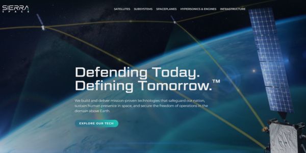
Sierra Space’s $550 million Series C round, valuing the company at $8 billion, signals a decisive shift toward defense-tech space. This feature unpacks the hardware, strategy, and risks shaping the next decade of orbital infrastructure.
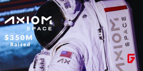
Axiom Space has locked in a fresh $350M raise to push its commercial space station and NASA lunar spacesuits toward launch, signaling growing investor faith in private orbital infrastructure.
Morpheus Space secures $15M funding for GO-2 electric propulsion mass production. Learn how this boosts satellite mobility with efficient thrusters.

Stoke Space extended its Series D funding to $860 million, fueling Nova’s full-reuse rocket production at Cape Canaveral. Backed by founders from Blue Origin, this pushes total capital to $1.34B.

Tomorrow.io has closed a $175 million equity round to deploy DeepSky, its AI-native weather satellite constellation designed to make global atmospheric data far more precise, frequent, and useful for businesses, governments, and communities facing extreme weather.

Stay ahead of AI and space tech wars: OpenAI vs Google AI, SpaceX and Blue Origin’s race for orbital data centers, Meta’s AI strategy shift, and key robotics breakthroughs reshaping industry.

Bridgit Mendler’s Northwood Space is pioneering mass-produced ground stations, enabling scalable, high-speed connectivity for the new era of satellite networks and megaconstellations.
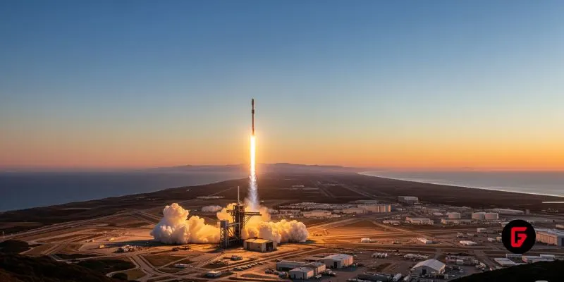
SpaceX aims to nearly double launches from Vandenberg in 2025, facing support from federal agencies but strong objections from the state and local communities.

NASA and Google’s AI-powered Crew Medical Officer Digital Assistant enables autonomous diagnoses for astronauts on Mars missions, redefining remote healthcare for space and Earth.
futureTEKnow is focused on identifying and promoting creators, disruptors and innovators, and serving as a vital resource for those interested in the latest advancements in technology.
© 2026 All Rights Reserved.