































SATLANTIS is a space technology company developing high-resolution optical payloads and Earth observation satellites. Its imaging systems capture visible, near-infrared, shortwave infrared, and other spectral information from orbit. The company’s technology supports environmental monitoring, methane emissions detection, infrastructure surveillance, and scientific research. SATLANTIS also provides complete small-satellite missions, combining its iSIM camera technology with spacecraft platforms, ground infrastructure, and data services for commercial and government organizations.
SATLANTIS designs, manufactures, and integrates optical imaging systems for satellites operating in Earth orbit. Its primary technology is the iSIM family of compact cameras, which capture multispectral imagery and video from CubeSats and microsatellites.
The company develops satellite cameras, optical instruments, image processing electronics, and spacecraft imaging systems. These components allow satellites to observe Earth’s surface, detect atmospheric gases, and collect data across multiple spectral bands.
SATLANTIS also provides end-to-end Earth observation missions, covering optical payload integration, satellite systems, ground segment coordination, and the delivery of imaging data to customers. Its spacecraft are designed to perform agile imaging maneuvers, enabling observations along coastlines, borders, pipelines, and other irregular geographic features.
Its technology has flown on missions including Urdaneta-ARMSAT1, GEISAT Precursor, HORACIO, GARAI A, and GARAI B. These missions support greenhouse gas monitoring, high-resolution imaging, and the validation of new satellite observation capabilities.
SATLANTIS develops compact optical imaging technology for small satellites, combining precision optics, image sensors, electronics, and onboard processing. Its core iSIM imaging architecture is designed to collect high-resolution observations across visible and infrared wavelengths while remaining compatible with CubeSat and microsatellite platforms.
The iSIM instruments support visible and near-infrared (VNIR) and shortwave infrared (SWIR) imaging. Different spectral bands reveal information that conventional visible-light cameras cannot capture, including changes in vegetation, surface materials, and atmospheric gas absorption.
SATLANTIS also develops agile satellite imaging technology that coordinates optical acquisition with spacecraft pointing maneuvers. This allows a satellite to follow non-linear geographic features such as coastlines, pipelines, and borders rather than collecting imagery only along a conventional straight orbital track.
Its imaging systems incorporate high-frame-rate acquisition, video capabilities, multispectral sensing, and, in selected configurations, polarimetric measurements. Polarimetry records properties of light polarization that can provide additional information about observed surfaces and atmospheric conditions.
The company’s iSIM-90 instrument is designed for compact CubeSat platforms, while iSIM-170 supports larger microsatellites and higher-resolution observations. Its GRAPHIUM optical payload is being developed for approximately 50-centimeter ground sampling distance, extending its technology toward very-high-resolution imaging.
SATLANTIS integrates these cameras with spacecraft systems and ground-based data processing to support complete Earth observation missions. Its FlexSat architecture combines multiple optical channels with spacecraft agility and onboard data fusion to improve coverage and observation flexibility.
Earth observation satellites provide information used to monitor environmental changes, industrial activity, infrastructure, and security conditions. SATLANTIS contributes to these applications through compact multispectral imaging systems that allow smaller spacecraft to collect detailed observations.
Its combination of visible and infrared imaging supports the detection and measurement of methane emissions, which are important for monitoring oil and gas infrastructure and identifying potential sources of greenhouse gases.
The company’s agile satellite observation technology also allows spacecraft to capture imagery along irregular geographic routes, potentially reducing the number of orbital passes required to monitor certain areas.
Through its complete satellite solutions and optical payload portfolio, SATLANTIS supports commercial Earth observation services, government monitoring programs, and scientific missions that require specialized imaging capabilities.
iSIM-90 is a compact multispectral optical imaging payload developed for 12U and 16U CubeSat platforms. It supports visible and near-infrared (VNIR) and shortwave infrared (SWIR) imaging, depending on its configuration. The instrument is used for Earth observation, methane emissions monitoring, environmental analysis, and technology demonstration missions.
iSIM-170 is a high-resolution satellite camera designed for microsatellite platforms. It provides visible, near-infrared, and shortwave infrared imaging capabilities, with video and other sensing modes available in selected configurations. The instrument supports detailed observation of infrastructure, geographic features, and environmental conditions.
GRAPHIUM is a very-high-resolution optical telescope under development for small satellite imaging missions. It is designed to achieve approximately 50-centimeter spatial resolution with panchromatic and visible-near-infrared imaging capabilities. The instrument incorporates advanced optical components, onboard electronics, and video acquisition technology.
CASPER is a thermal infrared observation instrument being developed for SATLANTIS’ next-generation satellites. It supports long-wave infrared measurements for thermal emission characterization, complementing the visible and shortwave infrared capabilities of the iSIM camera family.
ELCANO is a new generation of multi-payload Earth observation satellites announced in June 2026. The architecture combines iSIM optical cameras, thermal imaging, video, and other sensors with agile spacecraft pointing. The planned five-satellite family includes ELCANO-I through ELCANO-V, with initial deployment scheduled for 2027.
GEISAT is SATLANTIS’ satellite mission program for detecting and monitoring methane and other greenhouse gas emissions. Its GEISAT Precursor spacecraft launched in June 2023, carrying an iSIM-90 VNIR-SWIR imaging payload for environmental monitoring applications.
GARAI A and GARAI B are Earth observation microsatellite missions equipped with multiple optical instruments. They combine iSIM-90 and iSIM-170 technology to capture multispectral, infrared, polarimetric, and video observations. GARAI A launched in January 2025, followed by GARAI B in March 2026.
SATLANTIS provides integrated satellite mission solutions combining optical payloads, spacecraft platforms, launch coordination, ground infrastructure, and imaging data services. These systems can be configured for commercial, government, and scientific missions requiring dedicated Earth observation capabilities.
SATLANTIS technology supports Earth observation and environmental monitoring through multispectral satellite imaging. Its visible and infrared sensors collect information used to identify methane emissions, monitor industrial facilities, evaluate vegetation conditions, and observe changes in land and coastal environments.
Its imaging systems also support defense, security, and infrastructure surveillance, including maritime monitoring, border observation, pipeline inspection, and the monitoring of critical facilities.
Additional applications include wildfire detection, agricultural monitoring, disaster response, scientific research, and space domain awareness. Its ELCANO FlexSat architecture is being developed for missions requiring multiple sensing capabilities and continuous observation along complex geographic routes.
iSIM-90 is designed for compact CubeSat platforms, including 12U and 16U configurations. iSIM-170 is designed for larger microsatellites and supports higher-resolution observations. Both instruments can capture visible and infrared imagery, depending on their configuration.
Yes. SATLANTIS uses shortwave infrared imaging technology to detect and monitor methane emissions. Its GEISAT mission program supports greenhouse gas monitoring for industrial facilities, pipelines, and environmental applications.
ELCANO is a family of multi-payload Earth observation satellites introduced in June 2026. The satellites are designed to combine optical imaging, infrared sensing, video, and other observation capabilities with agile spacecraft pointing. Initial deployments are planned for 2027.
Yes. SATLANTIS has developed and integrated spacecraft missions including Urdaneta-ARMSAT1, GEISAT Precursor, HORACIO, GARAI A, and GARAI B. The company uses external launch providers to transport these satellites into orbit.
Satellite agility refers to a spacecraft’s ability to change its pointing direction while collecting imagery. SATLANTIS uses agile observation technology to follow geographic features such as borders, pipelines, and coastlines, allowing satellites to capture data along routes that do not follow a straight orbital track.
Have an update, correction, or additional information about this company? Help us keep the futureTEKnow company database up to date by submitting the latest company information.

Turion Space has raised more than $75 million in Series B funding to scale its Starfire platform and satellite fleet, betting that space domain awareness is the next critical defense infrastructure layer. The piece unpacks Turion’s business model, contracts, and risks for operators and investors watching the new space intelligence stack.

Pulsar Fusion’s Sunbird fusion rocket has achieved first plasma, validating its exhaust architecture and edging a reusable “space tug” concept toward sub‑six‑month Mars transfers. Drawing on multiple reports, this piece breaks down how the Dual Direct Fusion Drive works, what the 2027 in‑orbit demo must prove, and which technical and regulatory hurdles still stand between Sunbird and operational deep‑space logistics.

Aetherflux is betting that orbital data centers can power the next wave of AI, shifting from laser power beaming to space-based compute as it targets a $2 billion valuation. For founders and investors, the company’s 2027 satellite plans highlight how quickly space infrastructure is converging with AI demand and reshaping the deep-tech funding landscape.
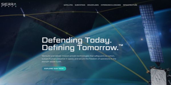
Sierra Space’s $550 million Series C round, valuing the company at $8 billion, signals a decisive shift toward defense-tech space. This feature unpacks the hardware, strategy, and risks shaping the next decade of orbital infrastructure.

Axiom Space has locked in a fresh $350M raise to push its commercial space station and NASA lunar spacesuits toward launch, signaling growing investor faith in private orbital infrastructure.
Morpheus Space secures $15M funding for GO-2 electric propulsion mass production. Learn how this boosts satellite mobility with efficient thrusters.

Stoke Space extended its Series D funding to $860 million, fueling Nova’s full-reuse rocket production at Cape Canaveral. Backed by founders from Blue Origin, this pushes total capital to $1.34B.

Tomorrow.io has closed a $175 million equity round to deploy DeepSky, its AI-native weather satellite constellation designed to make global atmospheric data far more precise, frequent, and useful for businesses, governments, and communities facing extreme weather.

Stay ahead of AI and space tech wars: OpenAI vs Google AI, SpaceX and Blue Origin’s race for orbital data centers, Meta’s AI strategy shift, and key robotics breakthroughs reshaping industry.

Bridgit Mendler’s Northwood Space is pioneering mass-produced ground stations, enabling scalable, high-speed connectivity for the new era of satellite networks and megaconstellations.
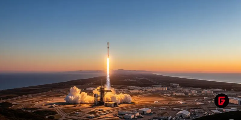
SpaceX aims to nearly double launches from Vandenberg in 2025, facing support from federal agencies but strong objections from the state and local communities.

NASA and Google’s AI-powered Crew Medical Officer Digital Assistant enables autonomous diagnoses for astronauts on Mars missions, redefining remote healthcare for space and Earth.
futureTEKnow is focused on identifying and promoting creators, disruptors and innovators, and serving as a vital resource for those interested in the latest advancements in technology.
© 2026 All Rights Reserved.