

































GalaxEye Space

GalaxEye Space is a space technology company that develops satellites for multi-sensor imaging and advanced geospatial analysis.

Headquarters

Bengaluru, Karnataka, India

Year Founded

2021

Website

GalaxEye Space

Sector

Space Industry

Industries

Earth Observation, Satellite Manufacturing, Remote Sensing, Geospatial Intelligence, Defense and Security, Agriculture, Maritime Monitoring, Infrastructure Monitoring, Disaster Management, Environmental Monitoring

What Is GalaxEye Space?

GalaxEye Space is an Indian Earth observation and satellite technology company developing spacecraft that combine synthetic aperture radar (SAR) and multispectral optical imaging. Its OptoSAR technology is designed to capture complementary measurements of Earth’s surface from a single satellite, addressing limitations associated with conventional radar-only and optical-only imaging systems.

The company’s technology portfolio includes multi-sensor satellite payloads, image fusion software, and geospatial data products. Its first satellite, Mission Drishti, launched in May 2026 but subsequently lost communication during early orbital operations. GalaxEye continues developing next-generation spacecraft and related imaging technology.

What Does GalaxEye Space Do?

GalaxEye Space designs satellite imaging systems that combine radar and optical sensors to collect different types of information about Earth’s surface. Its synthetic aperture radar instruments transmit microwave signals and measure their reflections, enabling observations during darkness and through most cloud conditions. Its multispectral optical sensors capture reflected sunlight across several wavelength bands to provide visual and spectral information.

The company’s SyncFusion technology processes and aligns measurements from these sensors, producing combined imagery intended to improve interpretation of geographic features, surface changes, and physical objects.

GalaxEye also develops onboard image processing and geospatial intelligence capabilities for applications including infrastructure monitoring, agriculture, maritime surveillance, disaster response, and defense. Following the loss of contact with Mission Drishti in 2026, the company announced plans to incorporate engineering lessons into subsequent OptoSAR spacecraft.

Join Our Newsletter

* indicates required

Intuit Mailchimp

ADVERTISEMENT
eMerge Americas 2027 Conference
ADVERTISEMENT
Submit Your Company | futureTEKnow

GalaxEye Space Technology

GalaxEye Space develops OptoSAR satellite imaging technology, integrating synthetic aperture radar and multispectral optical sensors on a common spacecraft platform. Radar and optical instruments observe different physical properties of Earth’s surface. Combining their measurements can provide more contextual information than either sensor type alone.

Its radar architecture uses X-band synthetic aperture radar, which transmits microwave signals and processes their reflections to generate images without relying on sunlight. Mission Drishti was designed with stripmap and spotlight imaging modes, including a stated SAR resolution of up to 0.9 meters in spotlight mode.

The optical payload incorporates a seven-band multispectral imager covering visible and near-infrared wavelengths, including coastal blue and red-edge bands. Its published native optical resolution is approximately 3.6 meters, while the company’s specified fused imagery resolution is approximately 1.8 meters.

GalaxEye’s SyncFusion image processing architecture uses co-registration, geometric correction, and AI-assisted processing to align radar and optical observations. Capturing both measurements from one spacecraft reduces temporal differences that can arise when combining images collected by separate satellites at different times.

The company has also tested its imaging technology using drones and high-altitude platforms. Mission Drishti, a spacecraft weighing approximately 190 kilograms, launched in May 2026 and completed important early-orbit spacecraft operations before communication was lost. Its planned OptoSAR imaging capability was therefore not established as a sustained operational satellite service.

Why GalaxEye Space Matters

Satellite imagery supports decisions involving natural disasters, infrastructure, agriculture, maritime activity, and national security. However, conventional optical satellites cannot reliably observe Earth’s surface through clouds or during darkness, while radar images can be more difficult to interpret without additional context.

GalaxEye addresses this limitation through combined radar and optical observations from a single spacecraft. Its OptoSAR architecture is designed to provide complementary surface measurements that can improve object identification, geographic monitoring, and change detection.

The launch of Mission Drishti demonstrated progress in integrating these sensing technologies into a privately developed satellite, although the subsequent communication failure prevented the planned imaging mission from becoming operational. GalaxEye’s follow-on spacecraft development will be important in determining whether its integrated sensing approach can support repeatable commercial Earth observation services.

GalaxEye Space Products & Platforms

Mission Drishti OptoSAR Satellite

Mission Drishti is GalaxEye’s first multi-sensor Earth observation satellite, integrating X-band synthetic aperture radar and a seven-band multispectral optical imager on one spacecraft. Launched on May 3, 2026, the approximately 190-kilogram satellite was designed to produce aligned radar and optical imagery. The spacecraft completed significant early-orbit activities before communication was lost following an anomaly in 2026. The planned operational imaging mission was not completed.

OptoSAR Imaging Payload

OptoSAR is GalaxEye’s integrated radar and optical imaging architecture. It combines SAR measurements with multispectral observations captured during the same satellite pass. The Mission Drishti configuration was designed for radar imaging resolutions down to 0.9 meters, multispectral imagery at approximately 3.6 meters, and fused imagery at approximately 1.8 meters. The technology is being incorporated into the company’s next-generation spacecraft development.

SyncFusion Technology

SyncFusion is GalaxEye’s multi-sensor image processing and data fusion technology. It uses co-registration, correction algorithms, and AI-assisted processing to align radar and optical measurements. The system is designed to produce combined geospatial datasets that preserve complementary information from both sensing methods, supporting object identification, surface monitoring, and change detection.

GalaxEye SURV

GalaxEye SURV is a geospatial monitoring and analysis solution identified in the company’s earlier industry product catalog. It combines remote sensing information with analytical workflows intended for surveillance and situational awareness applications. Detailed information about its current commercial availability and technical configuration is limited.

GalaxEye Blue

GalaxEye Blue is an imagery-related software offering listed in the company’s earlier IN-SPACe product catalog. It forms part of GalaxEye’s broader geospatial technology portfolio. Public technical specifications and its current product status are not sufficiently documented to establish additional capabilities.

GalaxEye Space Applications

Defense and Security: Combining radar and optical observations to support geographic surveillance, infrastructure assessment, and monitoring of strategically important locations.

Disaster Management: Using radar observations to assess flooding, storm damage, and other environmental changes when clouds or darkness restrict conventional optical imaging.

Agriculture: Analyzing multispectral observations and radar measurements to monitor vegetation conditions, agricultural land, and changes affecting crop production.

Infrastructure Monitoring: Observing transportation corridors, industrial facilities, construction activity, and changes in surrounding terrain.

Maritime Monitoring: Supporting the identification and monitoring of vessels, coastal infrastructure, and maritime activity through radar-based observations.

Environmental Monitoring: Combining multiple sensing methods to study land-cover changes, vegetation, water resources, and other geographic conditions.

Latest Companies

ADVERTISEMENT
Track AI, Robotics & Space Startups

Frequently Asked Questions

What is GalaxEye’s OptoSAR technology?

OptoSAR combines synthetic aperture radar and multispectral optical imaging on a single satellite. The system is designed to capture complementary radar and optical measurements during the same orbital pass, providing more information about Earth’s surface than either sensing method alone.

What happened to GalaxEye’s Mission Drishti satellite?

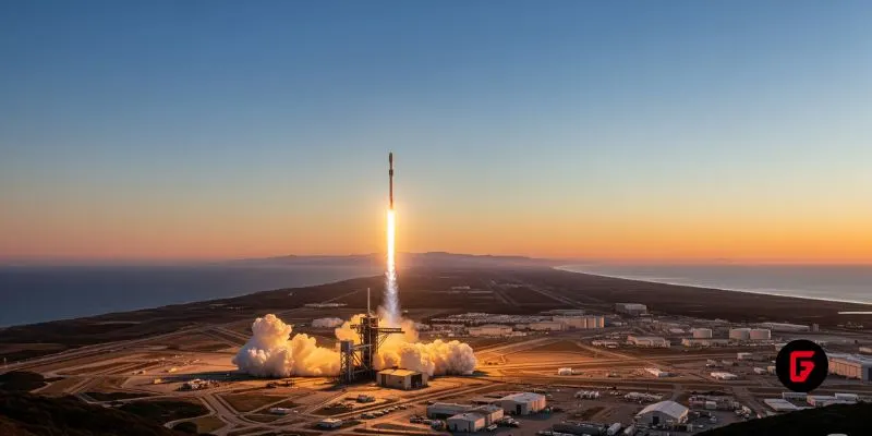
Mission Drishti launched on May 3, 2026, aboard a SpaceX Falcon 9. In July 2026, GalaxEye confirmed that communication with the spacecraft had been lost following an anomaly potentially associated with a geomagnetic storm. The satellite completed several early-orbit engineering activities, but recovery was considered unlikely and its planned operational imaging service was not established.

How does SyncFusion combine satellite images?

SyncFusion processes radar and optical measurements using image registration, correction algorithms, and AI-assisted data processing. Because the observations originate from sensors on the same spacecraft, the technology can reduce differences in acquisition time and viewing conditions that complicate fusion of imagery from separate satellites.

Can GalaxEye’s satellites capture images at night?

The company’s OptoSAR architecture incorporates synthetic aperture radar, which can acquire observations during darkness and through most cloud conditions. Its optical sensor provides additional multispectral information when lighting and atmospheric conditions permit. The combined system is designed for more consistent observation, although optical measurements remain subject to environmental limitations.

Is GalaxEye developing additional satellites?

Yes. Following the Mission Drishti communication failure, GalaxEye announced plans to develop two next-generation OptoSAR satellites over approximately 24 months. The company also indicated that it would expand its internal spacecraft manufacturing and integration capabilities to incorporate lessons from its first orbital mission.

Related Companies

Pixxel

ICEYE

Synspective

Do You Have an Update for This Company?

Have an update, correction, or additional information about this company? Help us keep the futureTEKnow company database up to date by submitting the latest company information.

Update Company Information

Latest Articles

Fusion rocket Sunbird ignites in a first plasma test, putting Pulsar Fusion’s high‑efficiency fusion rocket Sunbird closer to sub‑6‑month Mars missions.

Fusion rocket Sunbird ignites: Pulsar Fusion’s plasma breakthrough for faster deep-space travel

Pulsar Fusion’s Sunbird fusion rocket has achieved first plasma, validating its exhaust architecture and edging a reusable “space tug” concept toward sub‑six‑month Mars transfers. Drawing on multiple reports, this piece breaks down how the Dual Direct Fusion Drive works, what the 2027 in‑orbit demo must prove, and which technical and regulatory hurdles still stand between Sunbird and operational deep‑space logistics.

Aetherflux orbital data center plans target a $2B valuation as the startup pivots from laser power beaming to space-based AI compute.

Aetherflux’s $2B orbital bet: space data centers for the AI age

Aetherflux is betting that orbital data centers can power the next wave of AI, shifting from laser power beaming to space-based compute as it targets a $2 billion valuation. For founders and investors, the company’s 2027 satellite plans highlight how quickly space infrastructure is converging with AI demand and reshaping the deep-tech funding landscape.

futureTEKnow is focused on identifying and promoting creators, disruptors and innovators, and serving as a vital resource for those interested in the latest advancements in technology.

© 2026 All Rights Reserved.