
























Planet

Learn about Planet Labs, a satellite imaging company providing Earth observation imagery and geospatial intelligence for agriculture, defense, and environmental monitoring.

Headquarters

San Francisco, California, USA

Year Founded

2010

Website

Planet

Sector

Space Industry

Industries

Aerospace, Earth Observation, Satellite Manufacturing, Satellite Constellations, Satellite Imaging, Remote Sensing, Geospatial Intelligence, Geospatial Data Analytics, Artificial Intelligence, Defense & Security, Precision Agriculture, Forestry, Environmental Monitoring, Climate Monitoring, Disaster Management

What Is Planet?

Planet Labs is a space technology company that designs, manufactures, and operates Earth observation satellite constellations. Its satellites collect optical and hyperspectral imagery used to monitor changes in land use, infrastructure, agriculture, natural resources, and environmental conditions.

The company combines frequent satellite imaging with cloud-based geospatial analytics, allowing organizations to observe locations repeatedly, compare historical conditions, and identify changes over time. Its satellite fleet includes PlanetScope, SkySat, Pelican, and Tanager spacecraft, supported by data processing systems and software for delivering imagery and derived intelligence.

What Does Planet Do?

Planet operates satellite constellations that capture imagery of Earth’s surface at different spatial resolutions and observation frequencies. Its PlanetScope satellites provide near-daily coverage of the world’s landmass, while SkySat and Pelican support higher-resolution imaging of specific locations.

The company’s Tanager hyperspectral satellites collect information across hundreds of spectral bands, supporting applications such as methane detection, vegetation analysis, and water quality monitoring.

Planet processes satellite observations into imagery products, mosaics, environmental measurements, and automated analytics. Its software uses machine learning to identify objects, detect infrastructure changes, and analyze patterns across large geographic areas.

Through the Planet Insights Platform, customers can access imagery archives, request satellite observations, analyze geospatial datasets, and integrate Earth observation information into existing applications through APIs and geographic information systems.

Join Our Newsletter

* indicates required

Intuit Mailchimp

ADVERTISEMENT
eMerge Americas 2027 Conference
ADVERTISEMENT
Submit Your Company | futureTEKnow

Planet Technology

Planet develops small satellite constellations and remote sensing technologies designed to collect Earth observation data at different spatial, temporal, and spectral resolutions. Its PlanetScope constellation uses hundreds of Dove and SuperDove satellites to image Earth’s landmass on a near-daily basis. SuperDove sensors collect eight-band multispectral imagery, supporting vegetation monitoring, land classification, and change analysis.

For detailed observation, Planet operates SkySat satellites capable of collecting approximately 50-centimeter imagery. Its newer Pelican constellation extends high-resolution imaging through improved optical systems, multiple spectral bands, and onboard edge computing. Pelican Generation 1 provides 50-centimeter-class imagery, while Generation 2 is designed for approximately 30-centimeter-class imaging.

The Tanager constellation uses hyperspectral imaging sensors that measure reflected light across more than 400 spectral bands. These observations can distinguish materials and chemical signatures that conventional RGB imagery cannot resolve, supporting methane detection and environmental analysis.

Planet’s cloud-native data infrastructure processes imagery into orthorectified scenes, multispectral products, time-series datasets, and geographic mosaics. Its AI and machine learning analytics support automated object detection, infrastructure monitoring, and quantitative measurements of environmental variables.

Planet SuperRes applies generative AI to enhance the visual detail of PlanetScope imagery. The company also develops APIs, geospatial processing services, and analytical tools that allow customers to work with large imagery archives and combine satellite observations with other datasets.

Why Planet Matters

Traditional satellite observation often involves trade-offs between geographic coverage, image resolution, and how frequently a location can be revisited. Planet addresses these challenges through multiple complementary satellite constellations that support broad monitoring and targeted high-resolution observation.

Its near-daily imaging capability makes it possible to examine changes in agricultural fields, forests, construction activity, infrastructure, and natural disaster impacts over time.

Planet’s combination of optical imagery, hyperspectral sensing, and automated analytics also expands the use of satellite data as an operational intelligence resource. Organizations can use repeated observations to investigate events, quantify environmental conditions, and support decisions across large geographic regions.

The company’s technology reflects a broader shift in the space industry from selling individual satellite images toward delivering continuously updated Earth observation datasets and analytical services.

Planet Products & Platforms

Planet Monitoring and PlanetScope

Planet Monitoring provides near-daily global Earth observation imagery collected by the company’s Dove and SuperDove satellites. PlanetScope imagery is available at approximately three-meter pixel resolution and includes multispectral information used to examine vegetation, land cover, infrastructure, and environmental change. Its high observation frequency supports geographic monitoring and time-series analysis across extensive areas.

Planet Satellite Tasking — SkySat and Pelican

Planet Satellite Tasking provides high-resolution imagery of selected locations through SkySat and Pelican satellites. SkySat delivers approximately 50-centimeter imagery with sub-daily tasking opportunities. The newer Pelican constellation provides 50-centimeter-class imaging through its first-generation spacecraft, with a second generation designed for approximately 30-centimeter-class resolution and improved observation capabilities.

Planet Hyperspectral — Tanager

Planet Hyperspectral uses Tanager satellites to collect measurements across more than 400 spectral bands. The technology supports methane and carbon dioxide emissions analysis, vegetation characterization, mineral identification, and water quality monitoring. Hyperspectral observations provide information about materials and chemical signatures beyond what conventional optical imagery can distinguish.

Planetary Variables

Planetary Variables converts Earth observation measurements into quantitative environmental datasets. Available products include soil water content, crop biomass, land surface temperature, field boundaries, and forest carbon measurements. These datasets support agricultural analysis, natural resource monitoring, and environmental assessments.

Planet Analytic Feeds

Planet Analytic Feeds applies machine learning and automated image analysis to identify objects and detect changes in satellite imagery. Available capabilities include vessel detection, aircraft detection, and road and building change detection, allowing customers to monitor activity without manually examining every image.

Planet Mosaics

Planet Mosaics combines multiple satellite images into consistent geographic datasets covering larger regions. The products reduce cloud interference and support repeated visual comparisons, mapping, and automated analysis through standardized imagery assembled over defined periods.

Planet SuperRes

Planet SuperRes uses generative AI-based image enhancement to transform three-meter PlanetScope imagery into a two-meter-resolution visual product. It is designed to improve interpretability for human analysts while preserving PlanetScope’s broad geographic coverage and frequent imaging. The enhanced output should not be confused with newly captured native two-meter sensor data.

Planet Insights Platform

Planet Insights Platform is a cloud-native geospatial data and analytics environment providing access to satellite imagery, historical archives, derived measurements, and analytical tools. Its applications and APIs support imagery discovery, ordering, visualization, processing, geographic analysis, and integration with external GIS and software systems.

Planet Applications

Precision Agriculture: Monitoring crop development, vegetation health, field conditions, and agricultural changes.

Environmental Monitoring: Tracking deforestation, ecosystem changes, land degradation, and conservation activity.

Defense and Intelligence: Observing infrastructure, transportation networks, and geographic activity through repeated satellite imagery.

Disaster Response: Comparing satellite observations before and after floods, wildfires, storms, and other natural disasters.

Climate and Emissions Monitoring: Using hyperspectral measurements to investigate methane emissions and other environmental indicators.

Infrastructure Monitoring: Detecting construction, road development, and changes to industrial facilities.

Maritime Intelligence: Detecting vessels and monitoring maritime activity through satellite imagery and automated analytics.

Forestry and Carbon Assessment: Measuring forest cover, vegetation changes, and aboveground carbon characteristics.

Geospatial AI Development: Providing imagery archives and analysis-ready datasets for training and evaluating machine learning models.

Latest Companies

ADVERTISEMENT
eMerge Americas 2027 Conference

Frequently Asked Questions

What does Planet Labs do?

Planet Labs designs and operates Earth observation satellites and provides imagery, environmental datasets, and geospatial analytics for commercial, government, and research applications.

How often does Planet image Earth?

PlanetScope satellites are designed to capture Earth’s landmass on a near-daily basis. Actual usable imagery frequency varies with cloud cover, imaging conditions, and geographic location.

What is the difference between PlanetScope and SkySat?

PlanetScope provides frequent imagery across large geographic areas at approximately three-meter pixel resolution. SkySat provides more detailed imagery of selected locations at approximately 50-centimeter resolution.

What is Planet’s Pelican constellation?

Pelican is a next-generation high-resolution Earth observation constellation designed for rapid satellite tasking. Its first-generation spacecraft provide 50-centimeter-class imagery, while the planned second generation targets approximately 30-centimeter-class resolution.

What does the Tanager satellite measure?

Tanager uses hyperspectral sensors covering more than 400 spectral bands to collect information about materials and environmental conditions, including methane emissions, vegetation characteristics, and water quality.

Does Planet use artificial intelligence?

Yes. Planet applies machine learning to satellite imagery for automated object detection, change analysis, and geospatial analytics. Its SuperRes product also uses generative AI to enhance the visual resolution of PlanetScope imagery.

What is Planet Insights Platform?

Planet Insights Platform is a cloud-based environment for accessing satellite imagery, analyzing geospatial datasets, processing observations, and integrating Earth observation information into external applications through APIs and GIS tools.

Related Companies

Marble Imaging

KaleidEO

Umbra

Do You Have an Update for This Company?

Have an update, correction, or additional information about this company? Help us keep the futureTEKnow company database up to date by submitting the latest company information.

Update Company Information

Latest Articles

Fusion rocket Sunbird ignites in a first plasma test, putting Pulsar Fusion’s high‑efficiency fusion rocket Sunbird closer to sub‑6‑month Mars missions.

Fusion rocket Sunbird ignites: Pulsar Fusion’s plasma breakthrough for faster deep-space travel

Pulsar Fusion’s Sunbird fusion rocket has achieved first plasma, validating its exhaust architecture and edging a reusable “space tug” concept toward sub‑six‑month Mars transfers. Drawing on multiple reports, this piece breaks down how the Dual Direct Fusion Drive works, what the 2027 in‑orbit demo must prove, and which technical and regulatory hurdles still stand between Sunbird and operational deep‑space logistics.
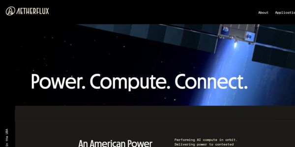
Aetherflux orbital data center plans target a $2B valuation as the startup pivots from laser power beaming to space-based AI compute.

Aetherflux’s $2B orbital bet: space data centers for the AI age

Aetherflux is betting that orbital data centers can power the next wave of AI, shifting from laser power beaming to space-based compute as it targets a $2 billion valuation. For founders and investors, the company’s 2027 satellite plans highlight how quickly space infrastructure is converging with AI demand and reshaping the deep-tech funding landscape.
futureTEKnow is focused on identifying and promoting creators, disruptors and innovators, and serving as a vital resource for those interested in the latest advancements in technology.

© 2026 All Rights Reserved.