


































Catania, Italy
2023
Earth Observation, Aerospace, Agriculture, Environmental Monitoring, Aviation, Urban Planning, Infrastructure, Disaster Management, Climate Technology, Geospatial Analytics
Space2Earth is a space technology company specializing in satellite data analysis and geospatial intelligence for environmental, agricultural, and infrastructure applications. The company uses Earth observation imagery, geographic information, and analytical software to examine physical conditions and changes across geographic areas. Its services combine artificial intelligence and remote sensing with specialist consulting to support business and institutional decisions. Space2Earth also develops applications for airport infrastructure assessment, environmental impact analysis, and weather-related risk monitoring.
Space2Earth acquires and analyzes satellite imagery to help organizations understand changes in land use, vegetation, infrastructure, and environmental conditions. Its consulting services draw on Earth observation data from public and commercial sources, including imagery associated with European satellite programs.
The company provides environmental and agricultural monitoring, applying image analysis to vegetation conditions, land-cover changes, crop development, and geographic risk factors. Its services also support urban planning and infrastructure assessment through satellite-based observations.
For airport operators, Space2Earth develops satellite-based infrastructure mapping and object detection intended to support maintenance planning, environmental assessment, and airport operations.
The company has also contributed to research combining satellite measurements, ground-based sensors, and numerical weather models. Its current business emphasizes tailored satellite intelligence consulting, data interpretation, and recommendations rather than the sale of satellite hardware or operation of its own spacecraft.
Space2Earth applies Earth observation data processing to satellite imagery acquired from public and commercial sources. Its analytical workflows examine multispectral and high-resolution observations to identify geographic features, monitor environmental conditions, and assess changes across selected locations.
The company incorporates artificial intelligence and object detection algorithms into geospatial analysis. These techniques support the interpretation of satellite images for infrastructure mapping, vegetation monitoring, and identification of features relevant to airport operations. Its work with airport operators includes developing satellite-derived mapping approaches that can supplement traditional ground surveys and airborne measurements.
For environmental applications, Space2Earth analyzes satellite observations to evaluate land-cover changes, vegetation conditions, pollution-related indicators, and climate-related risks. Agricultural analysis includes crop monitoring and yield estimation, while urban applications examine infrastructure development and changes in built environments.
Space2Earth has also contributed to high-performance computing and multi-source data integration through the HPC-XTREME research project. Its activities included preprocessing and harmonizing satellite observations, combining meteorological and thermal measurements with ground-based Internet of Things sensors, and preparing datasets for numerical weather models.
The research involved computational workflows for handling large volumes of spatial and temporal information, with applications in extreme-weather prediction near airports. Space2Earth contributed to data assimilation, simulation processing, and analysis supporting early-warning and operational decision-making.
Its technology is delivered through consulting, custom analytical workflows, and geospatial information services. Although the company advertises an AI-powered satellite intelligence platform, publicly available documentation does not establish a named, independently verified commercial software product with published technical specifications.
Satellite imagery provides repeated observations of large geographic areas, but converting those images into information useful for operational decisions requires specialized processing and interpretation. Organizations often need to combine satellite measurements with local information and industry-specific analytical requirements.
Space2Earth addresses this challenge through satellite-based geospatial consulting that connects Earth observation data with environmental, agricultural, and infrastructure monitoring.
Its airport infrastructure and weather research demonstrates applications beyond conventional satellite image visualization, including the integration of remote sensing with numerical models and ground sensors.
These capabilities can reduce dependence on certain physical surveys and provide additional information for evaluating geographic changes. The company’s work reflects the growing role of downstream space services in converting satellite observations into practical information for businesses and public institutions.
Space2Earth provides satellite-based environmental analysis services using multispectral imagery and geographic data. Its services examine vegetation changes, deforestation, pollution-related indicators, and environmental conditions across selected areas. The resulting analysis supports organizations evaluating environmental impacts, land management decisions, and changes in natural ecosystems.
The company’s agricultural services use remote sensing and AI-assisted imagery analysis to examine crop development, vegetation conditions, and agricultural land. Its published service offerings include crop monitoring and yield prediction. These capabilities are intended to help agricultural organizations evaluate field conditions and support decisions about production and resource management.
Space2Earth offers geospatial analysis for urban and infrastructure monitoring. Its services use satellite imagery to examine changes in developed areas, identify infrastructure features, and support planning activities. The company has also worked on satellite-derived mapping techniques for airport infrastructure, including object detection and environmental assessment.
Space2Earth provides satellite data analysis for environmental risk assessment and disaster monitoring. Its services examine geographic and environmental conditions associated with natural hazards. Related research includes integrating satellite observations and ground-based sensors into high-performance numerical models for extreme-weather prediction and early-warning applications.
Environmental Monitoring: Analyzing satellite imagery to assess vegetation, land-cover changes, ecosystem conditions, and environmental impacts.
Precision Agriculture: Monitoring crop conditions, examining agricultural land, and supporting yield estimation through remote sensing data.
Airport Infrastructure: Applying satellite imagery and object detection to airport mapping, infrastructure assessment, and operational planning.
Extreme-Weather Analysis: Integrating Earth observation data, ground sensors, and numerical models to support weather-risk research and early-warning systems.
Urban Planning: Monitoring development patterns, infrastructure changes, and geographic conditions relevant to city management.
Disaster Risk Assessment: Evaluating satellite-derived environmental information to support preparedness and assessment of natural hazards.
Environmental Consulting: Providing satellite-based evidence and geographic analysis for organizations evaluating the environmental effects of their activities.
Space2Earth specializes in analyzing satellite imagery obtained from existing Earth observation sources rather than manufacturing or operating its own satellite constellation. Its services use publicly available and commercial satellite data to provide environmental, agricultural, and infrastructure intelligence.
Space2Earth develops satellite-based mapping and object detection techniques for airport infrastructure. Its work includes analyzing geographic features, supporting infrastructure assessment, and examining environmental conditions. The company has also contributed to research integrating satellite observations and ground sensors into numerical weather models for extreme-weather analysis near airports.
Space2Earth participated in HPC-XTREME, a research project developed with the University of Messina and Italspazio. Its work involved integrating satellite observations, meteorological measurements, and ground-based sensors into high-performance numerical models. The project examined extreme-weather prediction around the airports of Catania and Reggio Calabria, including data processing and early-warning applications.
Yes. Space2Earth is listed in the European Space Agency’s Business Incubation Centre network through ESA BIC Turin, with an incubation period covering 2024 to 2026. ESA identifies the company as a downstream Earth observation startup developing satellite data analytics, particularly for airport operations and environmental assessment.
Space2Earth was established in June 2023 and is based in Catania, Sicily. The company began with satellite imagery and environmental data analysis and subsequently expanded its emphasis on strategic consulting for organizations using Earth observation information. Its current services cover environmental monitoring, agriculture, infrastructure, and geographic risk assessment.
Have an update, correction, or additional information about this company? Help us keep the futureTEKnow company database up to date by submitting the latest company information.

Turion Space has raised more than $75 million in Series B funding to scale its Starfire platform and satellite fleet, betting that space domain awareness is the next critical defense infrastructure layer. The piece unpacks Turion’s business model, contracts, and risks for operators and investors watching the new space intelligence stack.

Pulsar Fusion’s Sunbird fusion rocket has achieved first plasma, validating its exhaust architecture and edging a reusable “space tug” concept toward sub‑six‑month Mars transfers. Drawing on multiple reports, this piece breaks down how the Dual Direct Fusion Drive works, what the 2027 in‑orbit demo must prove, and which technical and regulatory hurdles still stand between Sunbird and operational deep‑space logistics.

Aetherflux is betting that orbital data centers can power the next wave of AI, shifting from laser power beaming to space-based compute as it targets a $2 billion valuation. For founders and investors, the company’s 2027 satellite plans highlight how quickly space infrastructure is converging with AI demand and reshaping the deep-tech funding landscape.
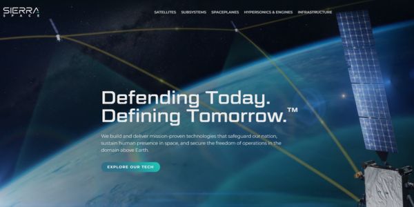
Sierra Space’s $550 million Series C round, valuing the company at $8 billion, signals a decisive shift toward defense-tech space. This feature unpacks the hardware, strategy, and risks shaping the next decade of orbital infrastructure.
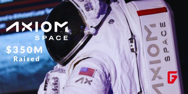
Axiom Space has locked in a fresh $350M raise to push its commercial space station and NASA lunar spacesuits toward launch, signaling growing investor faith in private orbital infrastructure.

Morpheus Space secures $15M funding for GO-2 electric propulsion mass production. Learn how this boosts satellite mobility with efficient thrusters.

Stoke Space extended its Series D funding to $860 million, fueling Nova’s full-reuse rocket production at Cape Canaveral. Backed by founders from Blue Origin, this pushes total capital to $1.34B.

Tomorrow.io has closed a $175 million equity round to deploy DeepSky, its AI-native weather satellite constellation designed to make global atmospheric data far more precise, frequent, and useful for businesses, governments, and communities facing extreme weather.

Stay ahead of AI and space tech wars: OpenAI vs Google AI, SpaceX and Blue Origin’s race for orbital data centers, Meta’s AI strategy shift, and key robotics breakthroughs reshaping industry.

Bridgit Mendler’s Northwood Space is pioneering mass-produced ground stations, enabling scalable, high-speed connectivity for the new era of satellite networks and megaconstellations.
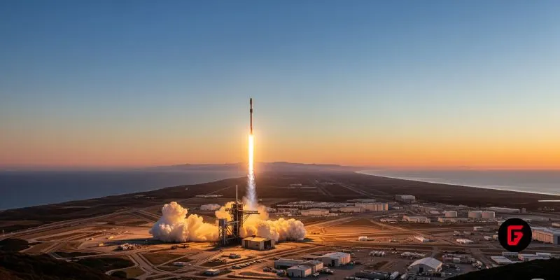
SpaceX aims to nearly double launches from Vandenberg in 2025, facing support from federal agencies but strong objections from the state and local communities.

NASA and Google’s AI-powered Crew Medical Officer Digital Assistant enables autonomous diagnoses for astronauts on Mars missions, redefining remote healthcare for space and Earth.
futureTEKnow is focused on identifying and promoting creators, disruptors and innovators, and serving as a vital resource for those interested in the latest advancements in technology.
© 2026 All Rights Reserved.